Thinking about moving to Lauderdale Harbours with your boat, but not sure if the canals, bridges, and ocean access will work for you? You’re not alone. Many out-of-state owners love the idea of docking at home, then cruising out to the Intracoastal or Atlantic, but want clear guidance before they buy. In this guide, you’ll learn how to assess canal widths and depths, plan bridge clearances, understand typical dock setups, and map out a safe route to the ocean. You’ll also get a practical checklist you can use right away. Let’s dive in.
Why Lauderdale Harbours fits boaters
Lauderdale Harbours is a waterfront neighborhood in the Fort Lauderdale metro area with private residential canals that connect to the Intracoastal Waterway. You get a true boating lifestyle with quick access to fuel, marinas, haul-out yards, and service pros. The area supports everything from day cruising to offshore runs during the peak boating season.
You should expect an urban waterway environment with a mix of recreational powerboats and smaller yachts. Traffic is heaviest on weekends and holidays, so planning around peak times can make your runs smoother.
Know your vessel numbers
Before you look at any dock, gather your boat’s core measurements. These determine your fit on a specific canal and route.
- LOA (length overall) and beam, including rubrails and dinghy davits.
- Maximum draft, including propeller and gear.
- Air draft, measured to the highest fixed point.
- Handling traits, like single vs. twin engines or bow thruster.
Keep these numbers handy. You’ll use them to evaluate canal width, turning room, depths, and bridge clearances.
Canals and maneuvering room
Residential canals in Fort Lauderdale vary widely. Some are generous and easy to navigate. Others are narrow and better suited for small boats.
- Measure the canal width at the dock using satellite tools like Google Earth or a charting app. Note the waterline-to-waterline distance.
- Identify the nearest intersection or turning basin. The distance to a wider area can determine whether you can pivot or back-and-fill comfortably.
- Ask about any marked channels on that canal. If there are buoys or a defined fairway, note the usable width.
- Confirm what size vessels are commonly kept on that canal. An HOA, dock neighbor, local captain, or nearby marina can share typical LOA and beam.
If you’re evaluating a larger boat or a wide-beam model, consider a local handling assessment with a captain or surveyor.
Depths, tides, and shoaling
Depths in residential canals can change. Shoaling after storms, sills near canal entrances, and marginal channels can affect access.
- Check official charts and any recent dredging notices for the area.
- Ask Broward County or local marinas about maintenance or dredge schedules.
- If you need certainty, arrange a depth check at mean low water with sonar.
Southeast Florida’s tidal range is modest compared with northern regions, but even small tides and storm surge can impact shallow slips. Build a margin of safety into your draft requirements.
Bridges and clearances
Your air draft planning is just as important as depth. Lauderdale Harbours routes can include a mix of fixed and bascule bridges, and clearances vary.
- List every bridge on your intended route to the Intracoastal and to the inlet you’ll use.
- Get vertical clearance numbers and opening schedules from official bridge tables.
- Factor in tide, since higher water reduces clearance under fixed spans.
- If your arch, antennas, or mast are close to the limit, decide whether they can be lowered safely.
For tall vessels, a precise air draft and an opening plan can make or break your route.
Ocean access and inlets
Most owners in Lauderdale Harbours use the Intracoastal Waterway to reach a nearby inlet, often the Port Everglades inlet. Exact time to the ocean depends on your dock location, boat speed, and traffic.
- Expect commercial traffic near Port Everglades. You should maintain a safe distance from large ships and tugs and follow the rules of the road.
- Consider transiting at off-peak times to avoid recreational congestion.
- Always check the latest marine forecast before heading offshore. Inlets can develop strong currents and rough bars, especially in adverse winds or seas.
If you plan overnight or offshore passages, make sure your vessel is properly outfitted and your crew understands local conditions.
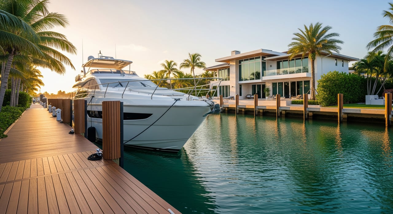
Private dock setups and utilities
Most Lauderdale Harbours homes with water frontage include a seawall and some combination of finger piers, pilings, and cleats. Utilities vary by property.
- Expect fixed seawalls with concrete or vinyl bulkheads, sometimes with floating sections.
- Shore power and potable water hookups are common but not guaranteed. Verify voltage and amperage at the pedestal.
- Pump-out access may require a mobile pump-out service or a quick run to a nearby marina.
- Many residential docks are set up for boats in the 20 to 50 foot range. Larger yachts often use commercial marinas or specialized piers.
Always confirm HOA or municipal rules about maximum LOA, beam, liveaboard status, and on-vessel work.
Marinas, yards, and service network
Fort Lauderdale is a major yachting hub with full-service marinas, shipyards, fuel docks, and provisioning. Nearby facilities include large shipyards and destination marinas that offer haul-out, mechanical service, bottom paint, and storage options.
- You will find multiple fuel docks and chandlers within short cruising distance.
- Towing and assistance providers operate on the Intracoastal and offshore.
- Many marinas have hurricane plans, owner-only guest rules, and clear liveaboard policies. Verify the details for your vessel and timeline.
This regional network simplifies maintenance and upgrades, even if you dock at home.
Hurricane season and insurance
Hurricane season runs from June through November. Planning ahead helps protect your vessel and can be required by insurers.
- Ask your insurer about address-specific requirements. Some policies require a haul-out or specific protections for named storms.
- Identify your hurricane options now. This may include a contracted haul-out, a reserved hurricane slip, or a detailed tie-up plan.
- Review seawall condition, piling heights, and dock hardware. Seawalls and docks require periodic maintenance to remain compliant with county regulations.
Include hurricane planning in your annual budget and timeline.
Daily lifestyle and neighborhood rhythm
Living on a canal comes with day-to-day positives and trade-offs.
- Advantages: direct water frontage, quick canal-to-ICW access, and proximity to service providers.
- Considerations: narrow canals can constrain maneuvering for larger boats. Residential rules may set quiet hours or limit commercial work at the dock.
- On busy weekends, plan your departures and returns to avoid congestion.
With a little planning, you can enjoy easy morning runs, lunch stops by water, and sunset cruises without stress.
Step-by-step relocation checklist
Use this list to evaluate a property and your route before you commit.
- Vessel data: Confirm LOA, beam, draft, and air draft to the highest fixed point.
- HOA and rules: Verify maximum allowed LOA and beam, any liveaboard limits, and whether on-vessel work is permitted.
- Utilities: Confirm shore power voltage and amps, water hookup, and pump-out options.
- Canal measurements: Measure canal width at the dock, distance to the nearest turning basin, and any marked fairway width.
- Depths: Check official soundings, any recent shoaling notices, and ask about dredging schedules. Consider a mean low water depth check.
- Bridges: List every bridge on your route, confirm vertical clearances and opening schedules, and calculate your air draft margin at various tides.
- Ocean route: Plot your ICW path to the preferred inlet and factor in commercial traffic near Port Everglades. Plan off-peak transits when possible.
- Services: Identify the nearest full-service marina, haul-out yard, fuel dock, chandlery, and towing provider.
- Hurricane plan: Confirm insurer requirements, pre-arrange haul-out or hurricane slip, and review your tie-up strategy.
- On-site inspection: Evaluate pilings, cleats, fendering, and electrical pedestal condition. Verify that your insurer will cover the vessel at that address.
- Specialist help: If unsure, schedule a local captain or surveyor for a maneuvering assessment or trial docking.
Mark these items complete before closing or relocating your boat.
Local contacts and resources
When you are ready to verify specifics, go straight to primary sources and local experts.
- Official charts and notices: NOAA nautical charts and ENC products, U.S. Coast Guard bridge tables and Notices to Mariners.
- Local government: Broward County Waterways and Navigation, City of Fort Lauderdale marine permitting for docks, seawalls, and dredging guidance.
- Safety and rules: Florida Fish and Wildlife Conservation Commission for boating rules, registration, and safety.
- Marinas and yards: Lauderdale Marine Center, Bahia Mar, Pier 66, and other Fort Lauderdale marinas for slips, fuel, pump-out, and haul-out.
- On-water help: TowBoatUS or Sea Tow for towing and assistance.
- Local knowledge: Speak with neighborhood HOAs or the local civic association, nearby captains, and marine surveyors for canal-specific insights.
A few calls can save you time and ensure a smooth boat-in.
Ready to evaluate a specific property?
If you are exploring Lauderdale Harbours or nearby enclaves, you deserve clear answers and a practical plan. As a boutique, hyperlocal team, we help you verify canal and route fit, coordinate local pros for depth and handling checks, and align HOA and insurance requirements so your move is seamless. For bilingual guidance and a high-touch approach, connect with Hanh Dinh to map your next steps.
FAQs
Will my 40 to 60 foot boat fit in Lauderdale Harbours canals?
- Start by confirming LOA, beam, and draft, then measure canal width and distance to a turning basin, check HOA size limits, and consider a local captain’s handling assessment.
Are bridge clearances an issue on routes to the ocean?
- List each bridge on your intended route, confirm vertical clearances and opening schedules, factor in tides, and verify whether your mast or arch can be lowered if margins are tight.
How long does it take to reach the ocean from Lauderdale Harbours?
- It depends on your exact dock location, speed, and traffic; plan conservatively and consider off-peak transits due to recreational and commercial congestion near inlets.
What dock utilities should I expect at a private residence?
- Many docks have shore power and water, but voltage and amperage vary; confirm pedestal specs and plan for pump-out via mobile service or a nearby marina.
How should I plan for hurricane season and insurance?
- Ask your insurer about address-specific requirements, pre-arrange a haul-out or hurricane slip, and review seawall, pilings, and tie-up strategies as part of your annual plan.